Local Dunblane Maps
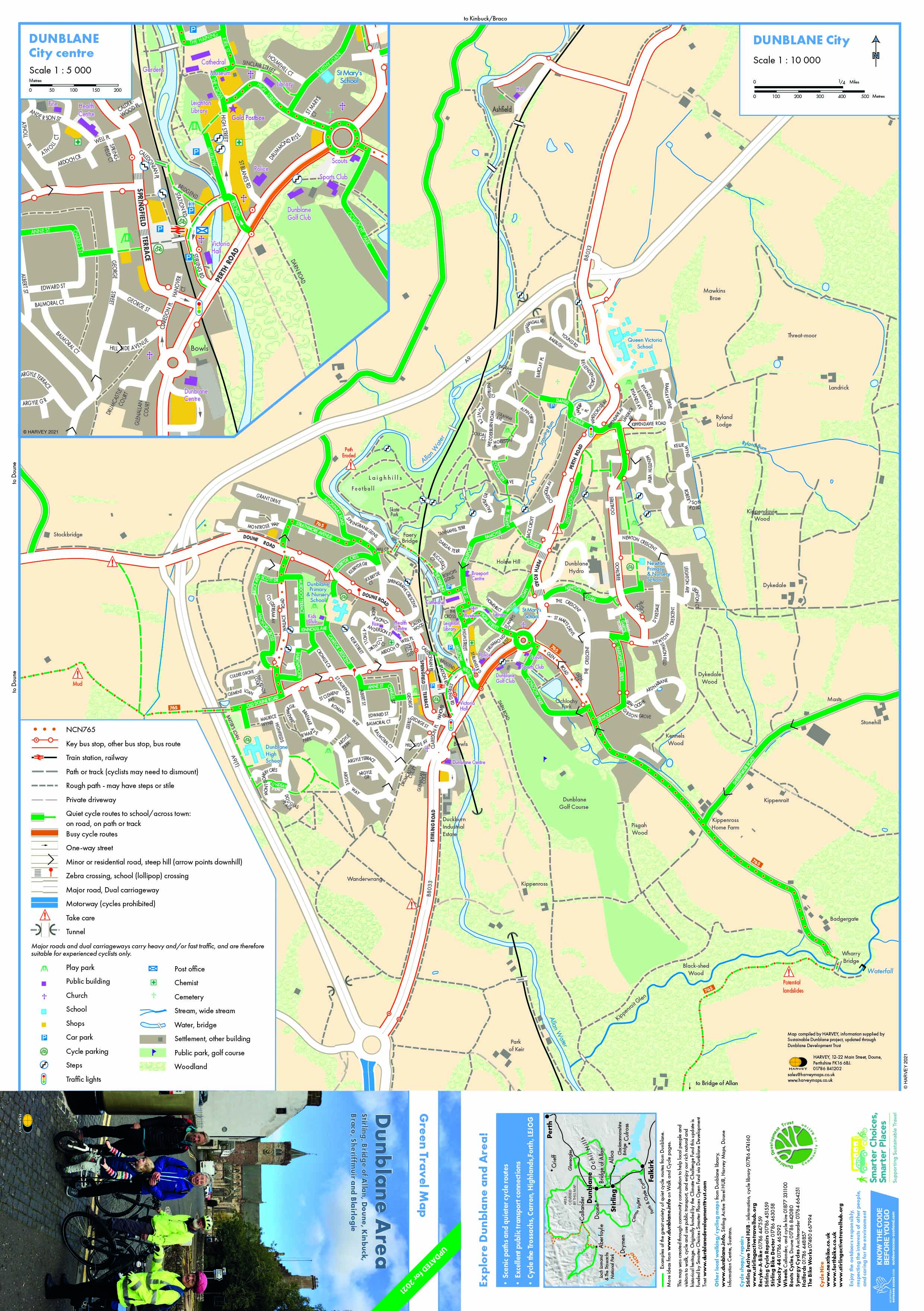
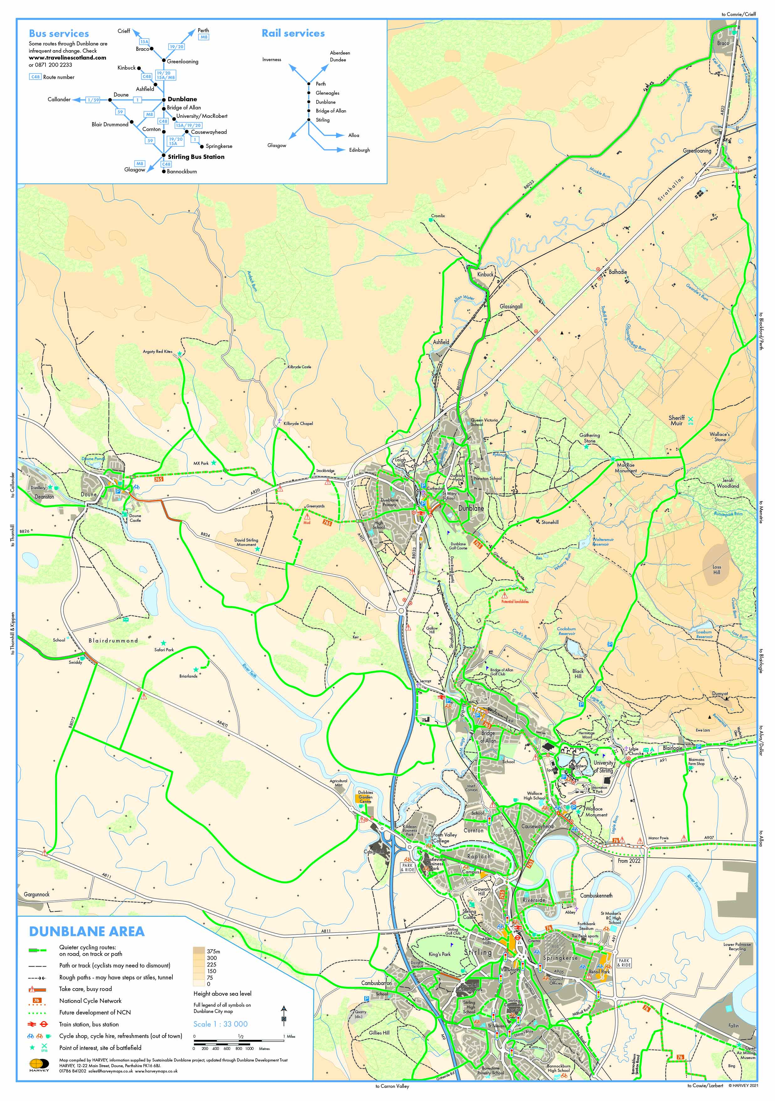
The Dunblane Area Green Travel Map helps local residents and visitors to walk, cycle and use public transport around Dunblane and the local Area towards Stirling, Doune and up into the Ochils. Free printed versions are usually available at Dunblane’s library, museum, Braeport Community Centre and schools. There is also an online indexed street map, and the maps are displayed at the station with local information and various leaflets with suggested walks and cycle rides in the Dunblane area can be found HERE
The three map formats originated from a widely consulted Climate Challenge Fund project in 2010-11 and were distributed free to schools and public outlets. They have been updated twice, in 2016 and 2021, by popular request through local surveys. Funding for the latest version was secured from ‘Smarter Choices Smarter Places Fund’ via Paths for All; with volunteers co-ordinating community input.
Three successive Walking, Cycling, Wheeling Infrastructure Improvements Reports have complemented the maps by coordinating suggestions to help people get around Dunblane Area. They have been made available to Stirling Council, consultants and community groups for upgrading active travel routes. The latest 2022 update can be seen HERE
 Dunblane Centre Map Local Area Map
The three map formats originated from a widely consulted Climate Challenge Fund project in 2010-11 and were distributed free to schools and public outlets. They have been updated twice, in 2016 and 2021, by popular request through local surveys. Funding for the latest version was secured from ‘Smarter Choices Smarter Places Fund’ via Paths for All; with volunteers co-ordinating community input.
Three successive Walking, Cycling, Wheeling Infrastructure Improvements Reports have complemented the maps by coordinating suggestions to help people get around Dunblane Area. They have been made available to Stirling Council, consultants and community groups for upgrading active travel routes. The latest 2022 update can be seen HERE